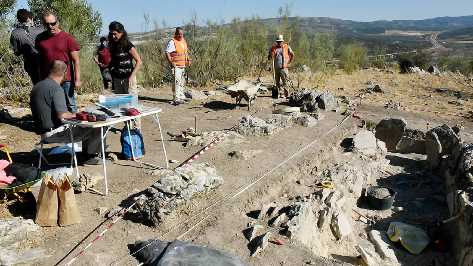
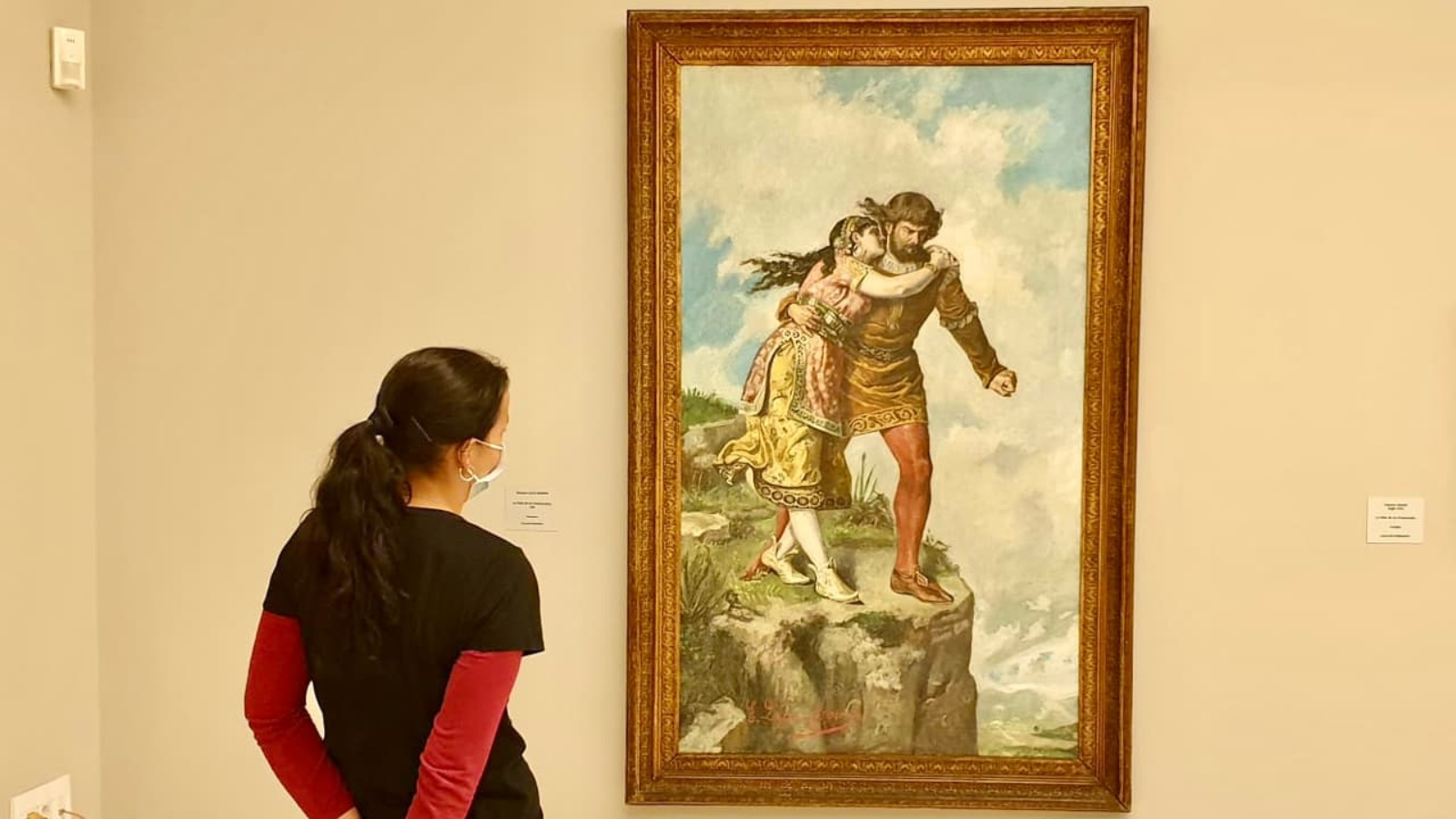
The Major of Antequera, Mr Manolo Barón, and the Delegated Deputy Majors for Historic Heritage, Mrs Ana Cebrián, and for World Heritage, Mr Juan Rosas, confirm the discovery in our municipality of what, up to now, it seems a non-identified megalithic monument. The news is known within the work of the experts from the Seville University who are carrying out searches in our municipality about the Antequera Megalithic Complex.
It is a very old megalithic monument whose location is not made public to keep the safety of the place as regards the research works being carried out as well as to avoid potential harmful actions which may damage them. This monument would be part of a sacred space for the Neolithic communities settled in our area before the Menga Dolmen was constructed.
Thanks to the new data found in the discovery and studios, we will also reach a better understanding of the processes leading to the Menga creation besides explaining its peculiar and pioneering orientation. The general purpose is to date more exactly the documented Neolithic activity in our municipality by applying methods of scientific dating such as radiocarbon and optically stimulated luminescence. In addition, we will get a better understanding of the existing society and environment in the time when Menga was constructed.
There are a great variety of bars and restaurants in Antequera and dependent villages where you will enjoy from the most traditional food to the most avant-garde one by the hands of professionals who will offer you many unforgettable experiences for all kind of dinners.
When we savour a traditional Antequera dish, we are not just consuming a product but a little bit of history. That is the case of the traditional porra antequerana, a kind of sick gazpacho, whose name is after the ”porra” (pestle) used by farmers to crush the ingredients, mainly bread, oil, garlic and tomato.
There are many bars and restaurants around all the quarters and streets of Antequera to enjoy a privileged scene together with a wide menu. Others typical dishes of the area are the ajoblanco (garlic and almonds thick soup), gazpachuelo (a kind of mayonnaise hot soup), migas (fried bread), ensalada de cardos (cardoon salad) and the pío antequerano (a kind of salad with orange and cod)
And for dessert, the ancient and expert hand of the confectioners and nuns from the convents present us with delicious dishes, such as the bienmesabe – a sweet made with grinned almonds, sponge fingers, eggs, sugar, and pumpkin angel hair- and the angelorum. Depending on the time of the year, we will also find the famous mantecado (lard burn), pestiños (fried pastry with sesame and cinnamon) torrijas (bread coated in butter with different flavours) and roscos (a kind of homemade doughnuts) which are typical of the Holy Week.
Mollete of Antequera
Special mention must be made of the mollete antequerano, a prestigious Antequera traditional product due to its maximum excellence and which, besides, it has been awarded with the Protected Geographical Indication. The Mollete de Antequera is a bread prepared with low baked wheat flour with a high humidity level, tender crumb, and a peculiar form as the base is of irregular elliptical shape and flat, little volume, and scraps from the making process.
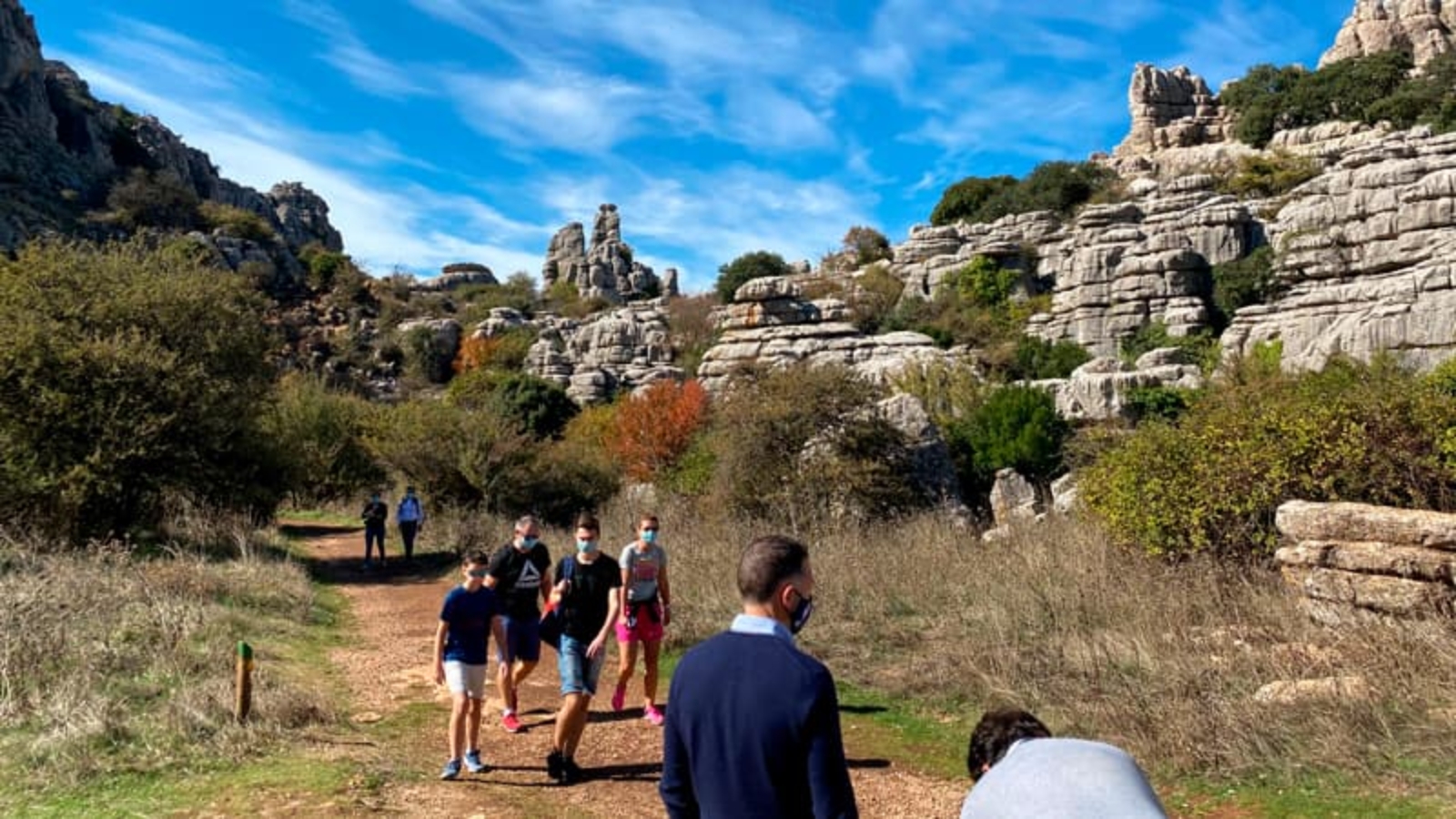
If you love hiking, Antequera offers you many different routes for all ages to enjoy countryside. Here you will find three hiking routes of 4, 10 and 14 kilometres to enjoy the best views.
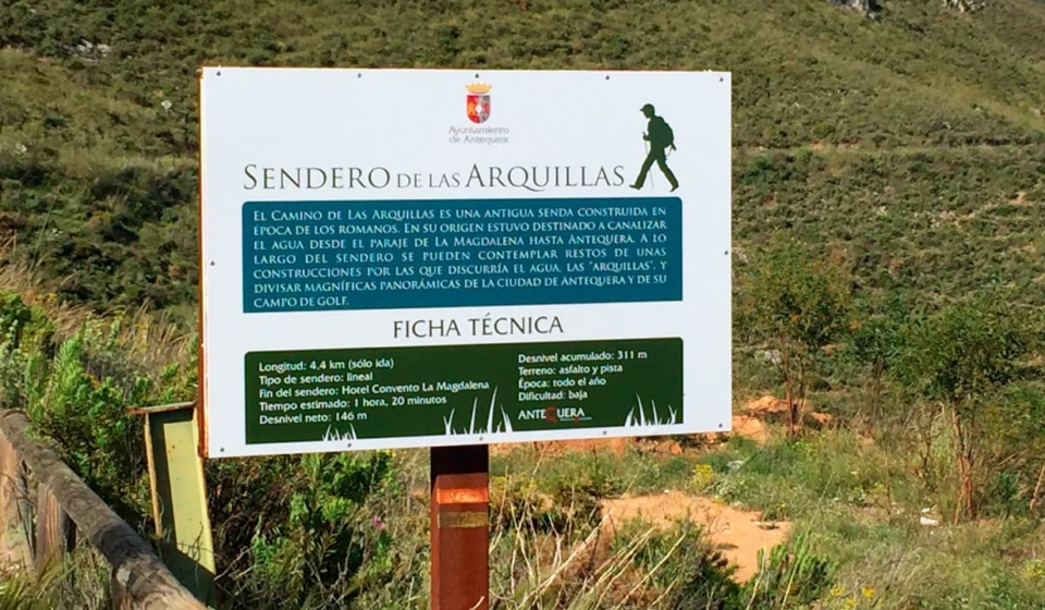
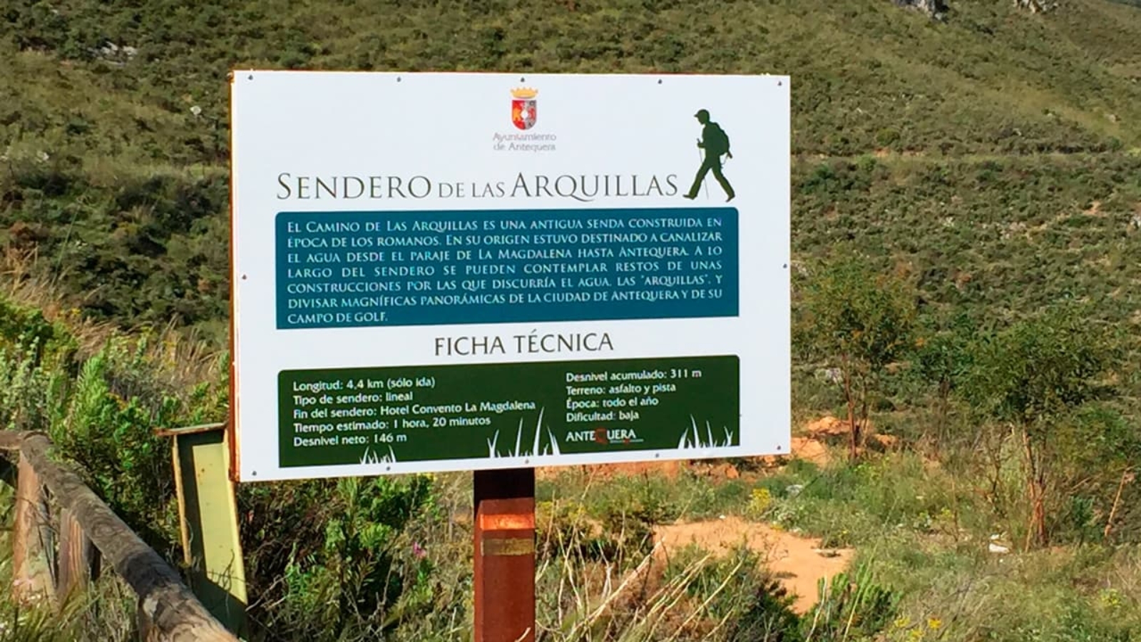
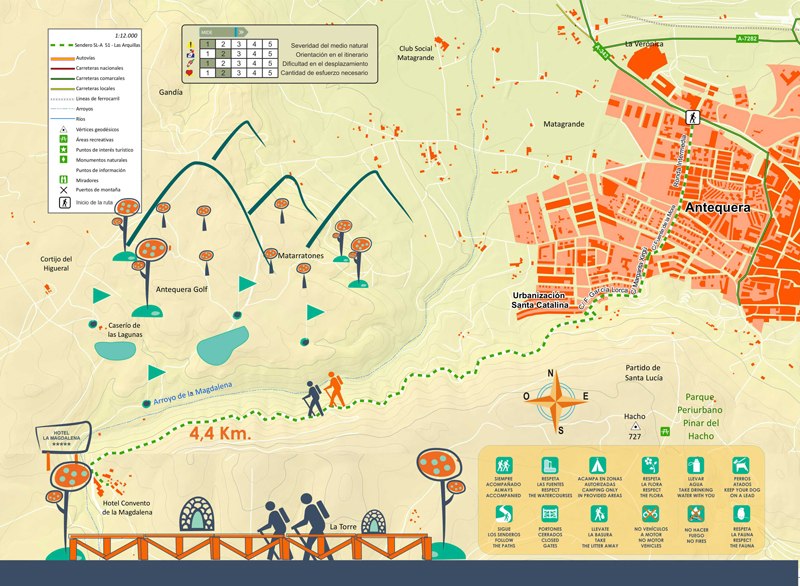
Las Arquillas Trail (SL-A 51)
Distance: 4.4. km Difficulty: Low
The trail starts through an urban section until reaching the Mirador de las Arquillas street where starts the countryside. Here you will find a sign indication “Ruta de las Arquillas”. The original purpose of this trail was to course the water from La Magdalena to Antequera -along the trail, there is a kind of constructions named “arquillas” (small arches) by which the water went through- going pass the Torre Hacho Outskirt Park lines and the Arroyo del Alcázar stream until reaching the Convento La Magdalena.
El Camino de Las Arquillas is a former Roman trail. Originally, it was thought to course the water from La Magdalena to Antequera. -along the trail, there is a kind of constructions named “arquillas” (small arches) by which the water went through-. To go through this route, we climb up on the left from the directional sign and, after a few meters of asphalt, we find the sign of start just when the earthy line begins in a little sloped bend on the right. From here, it starts a very smooth route which goes through the Arroyo del Alcázar stream and from which you will enjoy magnificent views of Antequera and of the sport space of the Hotel Antequera Golf. The trail takes us to the Hotel Convento La Magdalena where the route finishes with spectacular views. In front, we will see the Sierra de las Chimenas and El Camorro Alto mountain ranges besides the El Torcal de Antequera and the Puerto de la Escaleruela mountain pass. To our right, we can see the Sierra del Valle de Abdalajis and El Chorro.reservoir.
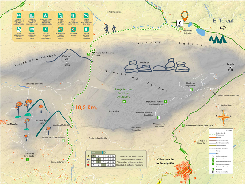
How to get: From Antequera we will take the county road A-7075 until arriving to the Nacimiento de la Villa river spring, a recreational area where we can start the route.
The trail starts from the Nacimiento de la Villa, next to the medium pool, and it finishes in the Cortijo de la Torre; it goes through the Escaleruela mountain pass within the limits of the Natural Landscape of El Torcal de Antequera, and it climbs up to the Cortijo de los Navazos.
The trail goes through the limits of the Natural Landscape of El Torcal de Antequera, in concrete through the Torcal Bajo (low), an area with a little bit less attractive landscape formations than those of the Torcal Alto (high). However, it shows other aspects of great interest, such as how the people have used this area along history.
Part of the route meets the so named Cordel from Antequera to Málaga. In ancient days, it was an important pass for livestock and people to go to Antequera when coming from Villanueva de la Concepción, Almogía and Alora villages. Some sources vouch for the existence of a former Roman road in the place.
The route is both ways; that it, it can be started from any of the ends: from the Cortijo de la Torre or from the Nacimiento de La Villa river spring. From the Cortijo de la Torre, where we find the fountain with the same name, we will climb up to the Cortijo de Robledillo, the link with a way coming from Villanueva de la Conception. We will follow towards Northeast through this large plateau near El Torcal Baio by gradually climbing up to the Cortijo de los Navazos. The landscape is shaped by formations of limestone rocks such as the North side of Las Vilaneras, a fault which separates the Torcal Bajo (low) from the Torcal Alto (high) and where some birds of prey net; and the Sierra de Chimena, which is crowned by the Camorro Alto (1,369 m) the highest point of this place and where, not long ago, it was possible to see an Arabic watchtower.
We will reach the Puerto de la Escaleruela mountain pass after which this route is named. From this point, we will enjoy great views of the Antequera town, with the working fields dotted with scattered farms, the Peña de los Enamorados (Lovers’ Rock), the Laguna de Fuente de Piedra lake, Sierras de Horconera y de Rute mountain ranges. We will also enjoy an overall view of El Torcal. Once in the lane, in the crossroad, we go to the right and open a gate for livestock -remember to close it again- and after walking through a lane a little bit lost among grass, we will arrive to another gate for livestock, we cross it and link with the GR-7 (Andalucía Large Route) which is part of the European Route E-4 from Tarifa (Cádiz-Spain) to Athens ). Our route finishes in the recreational area of the Nacimiento de la Villa, at the foot of the Sierra Pelada, where a mountain spring flows with a plentiful volume of water, the La Villa stream, which is the origin of the filtrations in the deep pits and chasms of El Torcal.
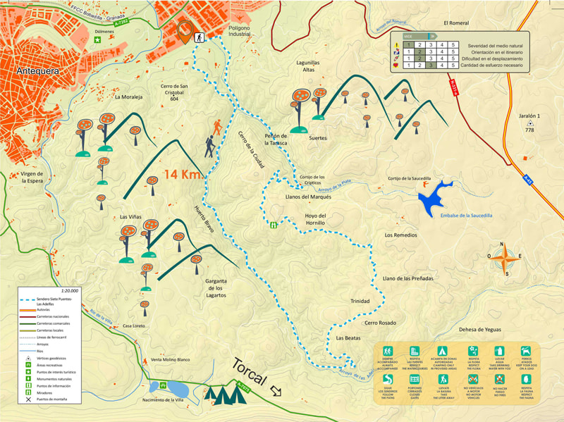
Distance: 14 km Circular route Difficulty: Average-Low
This circular route starts at the Punto Limpio (recycling area) placed next to the Polígono Industrial de Antequera (Industrial area) through an asphalted road up to the Cementera; from there, there is a lane finishing in the Cantera de Áridos (aggregates quarry) where a steep climb starts; we go through a Mediterranean forest to, afterwards, go down until getting to the Arroyo de las Adelfas stream.
To cross the stream, there are a small bridge and a dyke. Once on the other side, we will follow a narrow trail during 4 km. This is a very nice part as we will enjoy spectaculars panoramic, such as the northside of the Sierra de El Torcal, narrow lanes, wealth of vegetation… we will have to cross the stream twice or three times; however, as there is little water it is easy if we use the rocks as support. We will find some ruins and, finally, we will get into a pretty pine groove.
After 5 km of the beginning of the route, we will get into a wide earthy line with views to El Torcal and the Sierra de las Cabras mountain range. This open lane goes in zig zag through several ups and downs sections, and it will take us to the start point of the route.
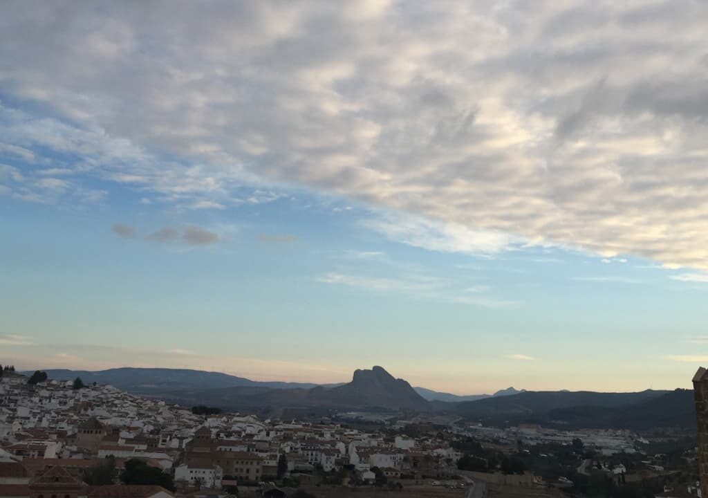
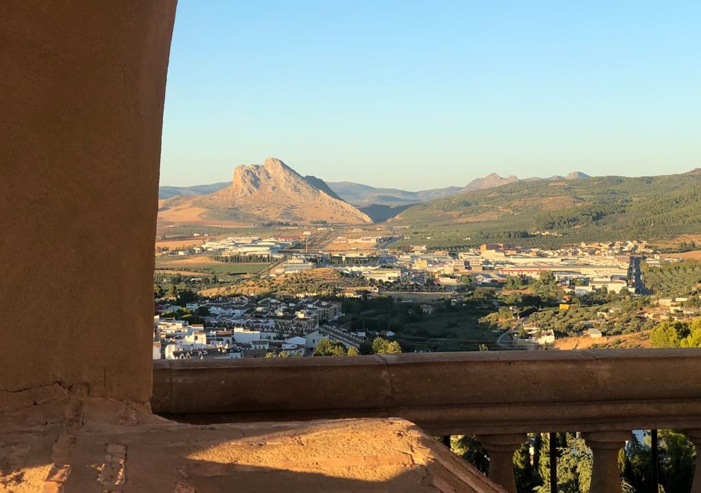
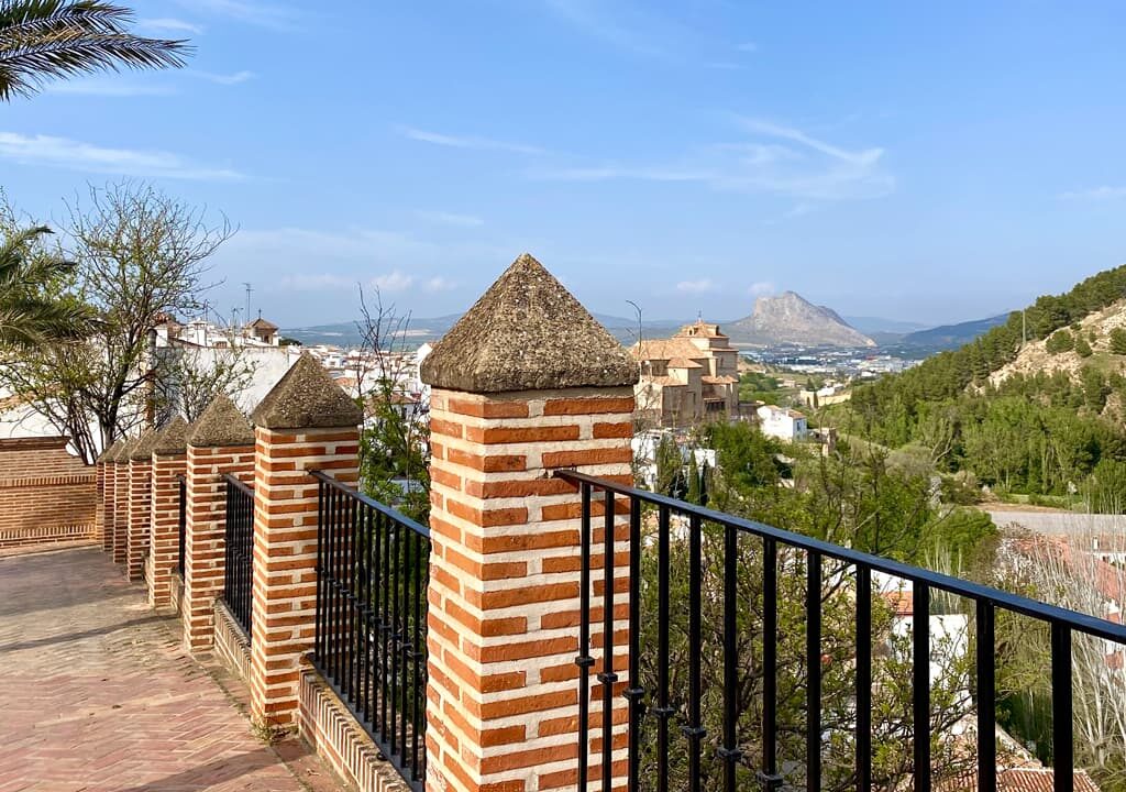
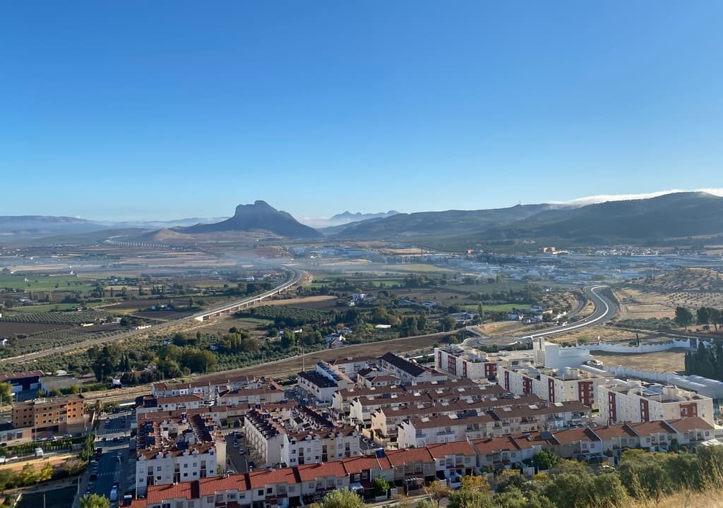
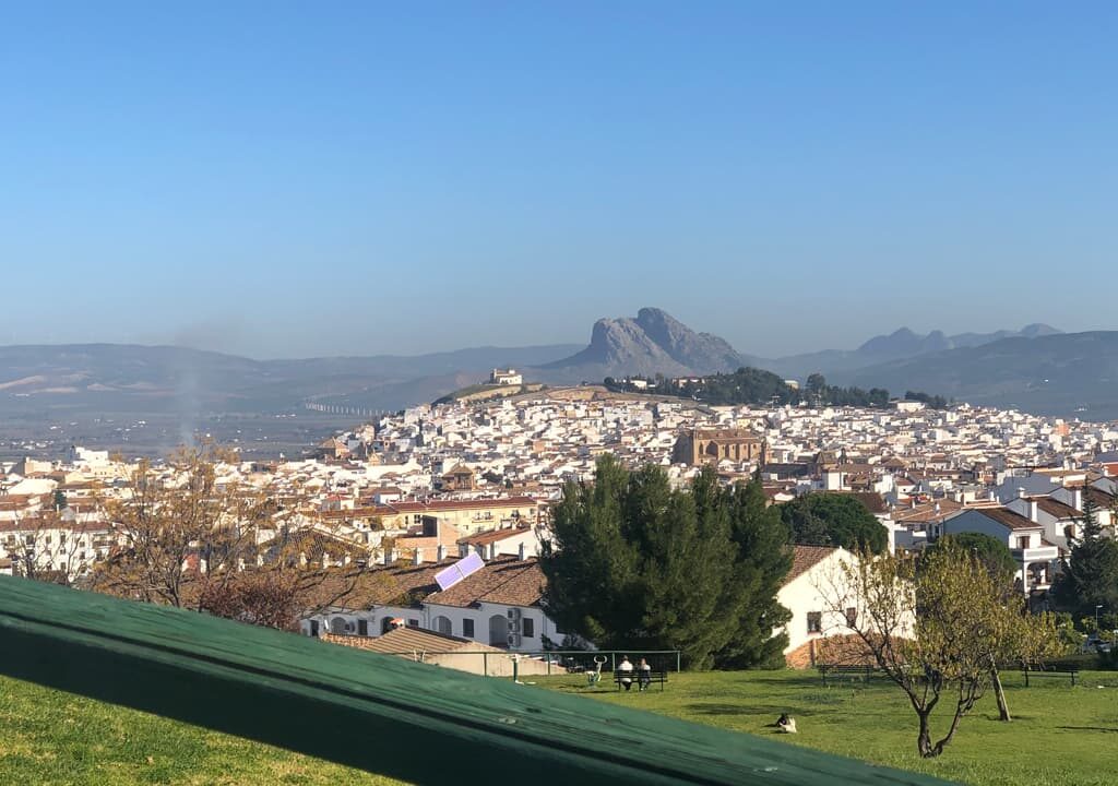
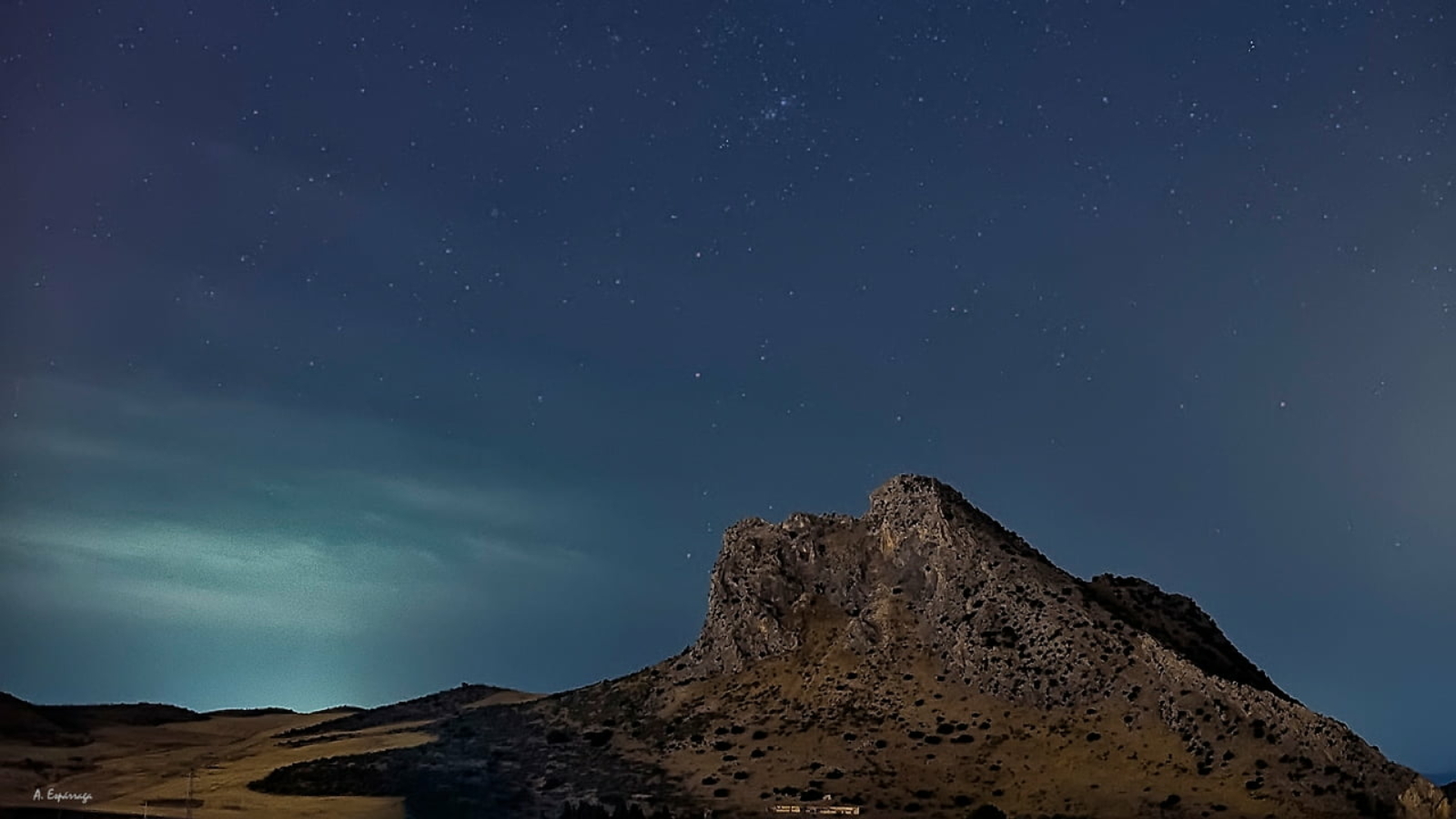
The Peña de Los Enamorados is not famous just because the legend after which is named but also because the curious profile looking like the face of a lying man. Some people even assures that it is the head of a Indian looking at the sky and, from there, the popular name of “the Antequera Indian”.
Although this whim of nature towers a great part of the Antequera landscape, we recommend seeing it and immortalising it from:
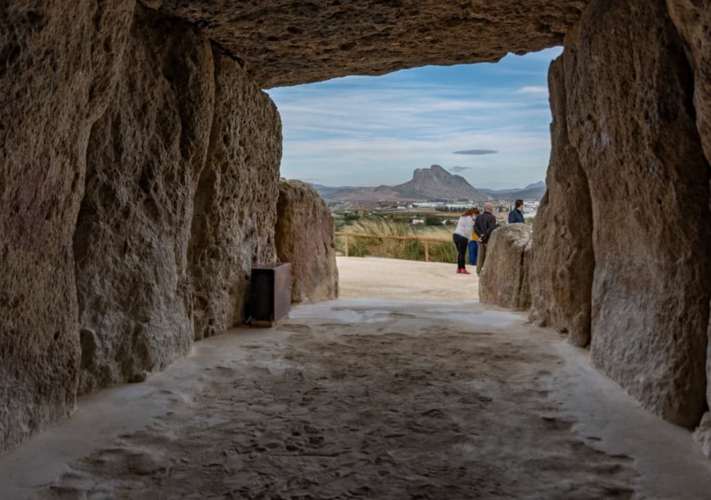
Once of the peculiarities of the Peña de los Enamorados is the close link with Menga, the sole Dolmen in the continental Europe facing an anthropomorphic mountain; reason by which it was awarded a UNESCO World Heritage. In concrete, the Menga’s central axis intersects this rock in a place at the Northwest side known as Abrigo de Matacabras, a housing element from Neolithic, with cave paintings in schematic style.
The Peña de los Enamorados’ natural landscape occupies an area of 117 hectares with great ecological value. It is declared as Asset of Cultural Interest because the archaeological significance of the area which has been settled since the Lower Palaeolithic.
From the subsequent settlements in La Peña over time, we keep some remains, such as carinated bowls and pots, big pots and jars from the Bronze Age. Likewise, it is possible to see some structural elements of Roman Times on the hillsides.
Due to the proximity and similar composition to the rock of El Torcal, the Peña de los Enamorados’s flora and fauna is quite similar to this natural landscape, mainly small reptiles and birds. The Guadalhorce River flows through the Rock side.
According to the popular legend, the daughter of the major of the neighbouring village of Archidona, Tazgona, and Tello, a Christian boy, fall deeply in love. However, they had to keep their relationship in secret because the race and religious differences. When her father found out the situation, Tello was captured to be executed but Tazgona managed to free him on time. Both run away and hid in a cave of the Peña de los Enamorados but, when they realized that the major’s army was getting closer to catch them, the young couple decided to seal their love for ever by jumping off.
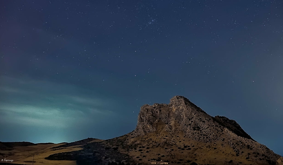
Antequera offers to nature lovers and, particularly, to hiking lovers a natural landscape to feast their eyes and enjoy pure air as the same time as they do their favourite sport. The El Torcal de Antequera hiking routes are worthwhile as you will get to know the native fauna and flora while enjoying the rock shapes designed by the whim of nature.
Local Programme
The main purpose of The Local Programme of the Torcal Alto Visitors Centre is that the El Torcal de Antequera Natural Landscape is valued and known through outreach and environmental education activities, events, and free -or with a symbolic cost- workshops as the International Day of Water; Stonework Art, La Botica de la Abuela, The Tree World Day…
Guided visits are always for reduced groups, with professional guides specialized in the landscape and through non-marked trails. In this way, you will get a more complete view of this beautiful place. There are guided visits for school children, with an educational purpose, and for groups and individuals. Among the visits, you will find: El Torcal, a tailor-made visit; El Torcal with the Family; The Route of the Senses; Legends and Mysteries of the Mountain Range; The Legacy of Stonecutters, Ammonites Route, Former Red Route…
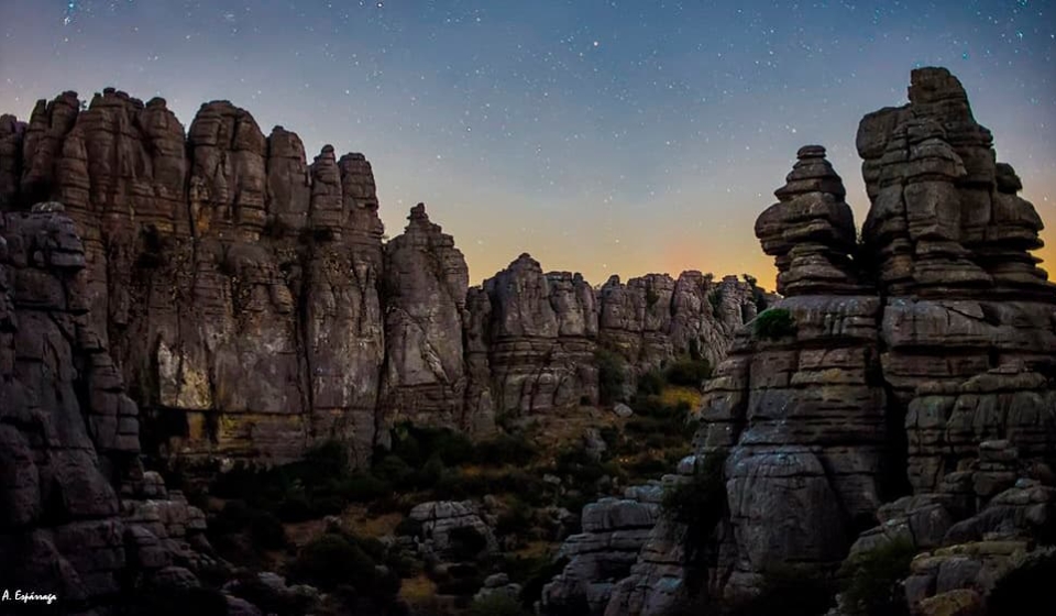
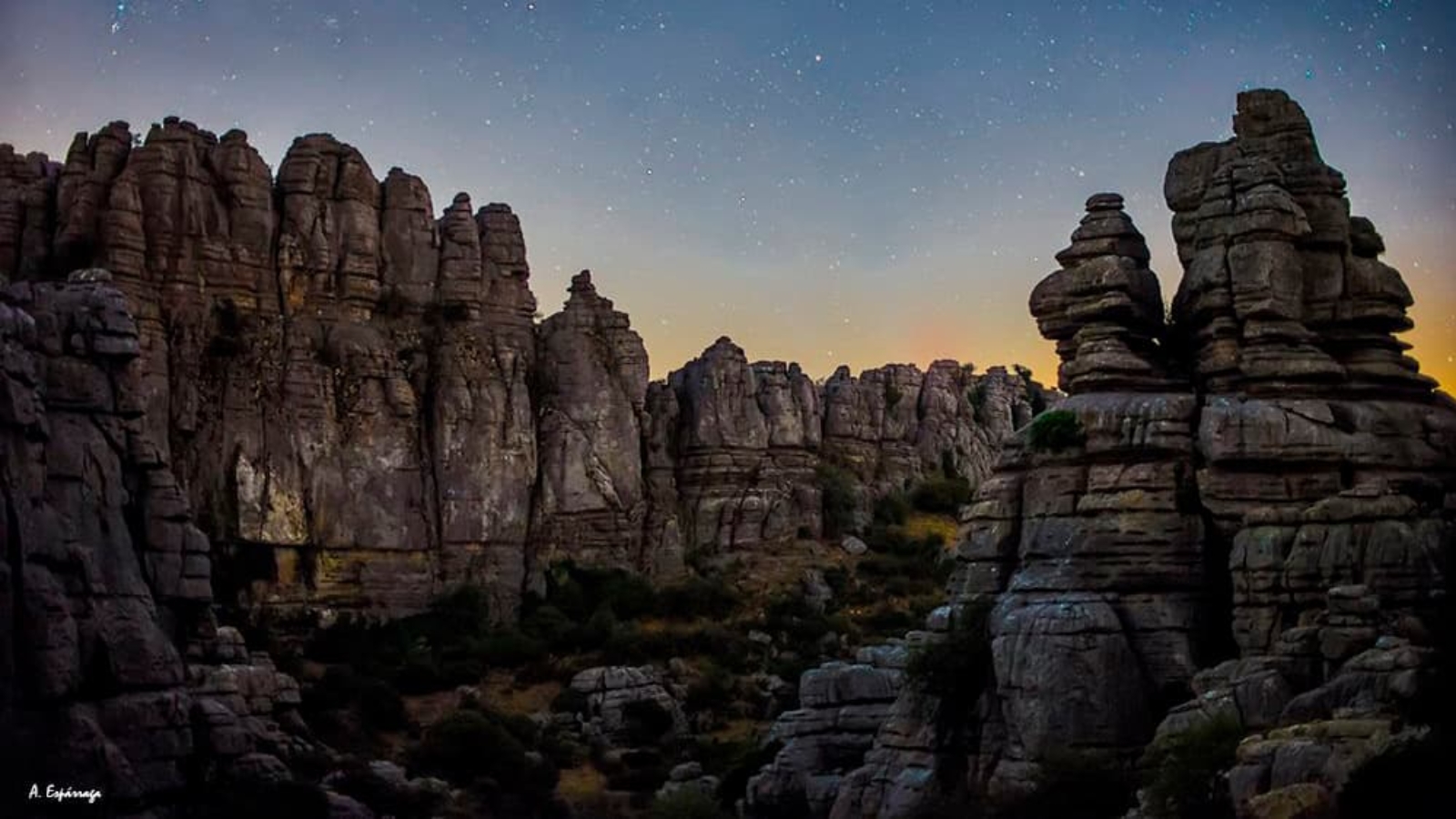
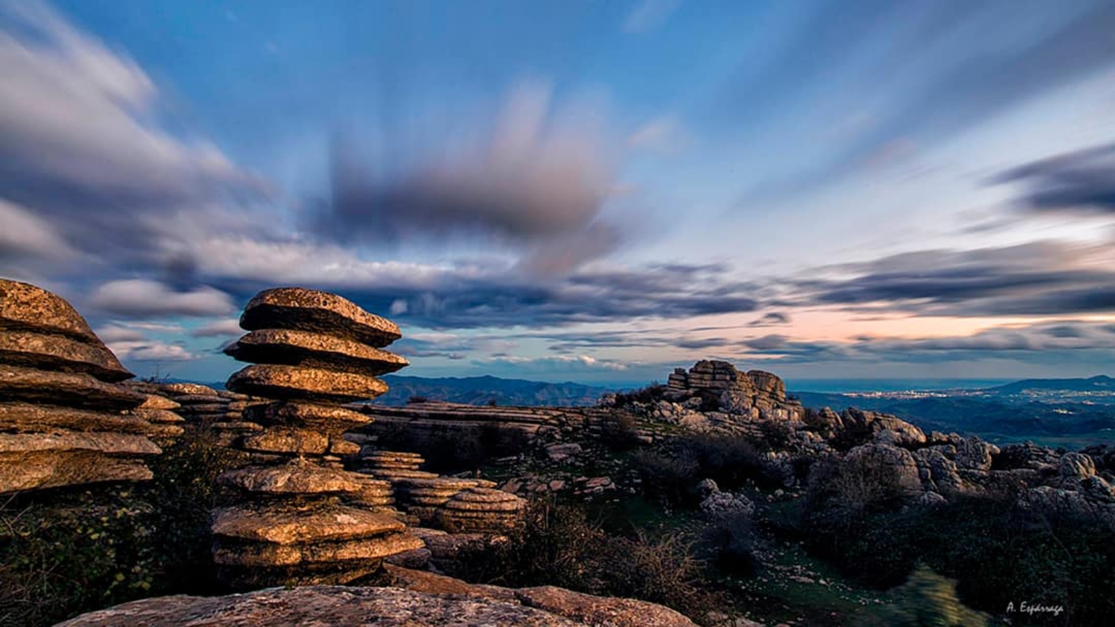
El Torcal, which is awarded as Natural Landscape, is mainly formed by limestones rocks created in the sea land during the Tertiary Period, more than 150 million years ago. The materials placed inside the sea emerged to the surface as consequence of the Alpine Folding. They kept a good part of its horizontally even though they rose more than one thousand meters over the sea level. From then on, it has been suffering an erosion process where the slow but continuous action of rain, snow and wind has shaped not only fanny rock shapes but also maze-like alleys which pass through the rocks and form interior circular sinkholes called dolines or “torcas” by which this natural space is named.
The area known as Torcal Alto (high) contains the most spectacular karst formations of the landscape. Here, the shapes of the rocks are so amazing that they have become popular by themselves: El Sombrerillo (small hat), El Cáliz (chalice), El Dado (dice), El Adelantado (the advanced one) or El Tornillo (screw), being the latter one awarded as Natural Monument for its original aspect which has turn it into a whole symbol of what this rock town offers and means.
In the Torcal Alto we will also find the two free-access marked routes: the Green Route (average-low difficulty) and Yellow Route (average difficulty). Both routes start at the parking area, very close to the Visitor Centre, and they go across many passages among amazing rock formations which will make your imagination run wild.
In the surrounding area of these two routes, visitors can also enjoy panoramic views from some viewpoints, such as Las Ventanillas (small windows) from where, in clear days, it is possible to see the African Continent.